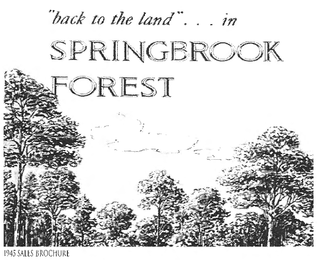
HISTORY OF
Back to the Land: The Early Years of Springbrook Forest 1945-1955
by Ellis Clough (1970)
In 1913 Charles Smith and Joseph Bradley bought the 209 acre tract that would become Springbrook Forest. In 1945 the land was being held by the widow of Mr. Bradley and heirs of Mr. Smith. An offer to buy came from George Moss, a builder who was developing "Springbrook just across the Northwest Branch. On August 6, 1945, Mr. Moss's company bought the "Mica Mine Farm". He remembers paying $35,000 for the whole tract, around $175 an acre. Almost immediately land for the Northwest Branch Park was sold to the Park and Planning Commission at $600 an Acre.
George Moss passed away in 194 at the age of 94. He was born in Lafayette, Louisiana and was the founder of the Moss Realty firm in Bethesda. In addition to Springbrook Forest other developments of his include Battery Park in Bethesda, Woodmore, Springbrook, and North Springbrook
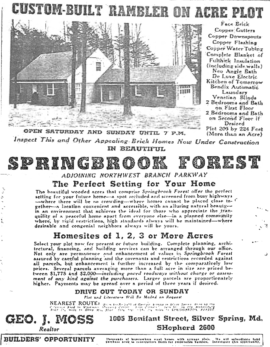
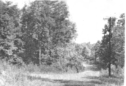
The early years of our neighborhood make an exciting story of "Trees and People" - of resolute 13 families carving homes and a community out of a friendly wilderness. Clearly SPRINGBROOK FOREST offered physical features, challenges and adventures not provided by most sections in our Suburbia during the 1945-54 period. The rolling terrain was almost completely covered with a tangled forest. Mr Moss described the land as "impenetrable". There were no dwellings within the tract. It was accessible only on the west by rough, winding 2-lane Kemp Mill Road black-topped from Arcola Avenue to just past the entrance, but only an unimproved country lane from there on to Glenmont-Colesville Road, now Randolph Road. Although 41 building plots were purchased during the first year of sales, June 1945-May 1946, there were no roads or streets within the Forest until late 1946, except that Stonington had been bulldozed out and roughly graded a few hundred feet toward Auth Lane. Remnants of the old mica mining and logging roads could still be seen but were not usable. Prospective buyers and actual purchasers parked their cars near the entrance and proceeded on foot through the timber to search out and inspect the plots or begin clearing operations.
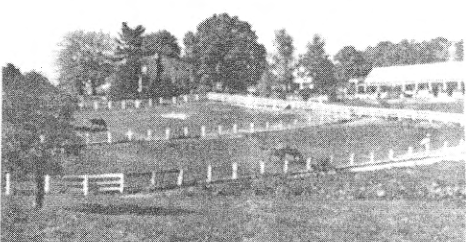
Unpolluted Northwest Branch made the northeastern-eastern boundary with the developing SPRINGBROOK estates on its other side. To the south, west across Kemp Mill, and north were horse farms, a saw mill, some Angus cattle, a few homes and acreages on Gray's Lane and Hermleigh Road, and more deep woods. Deer, fox, wild turkeys, raccoon and smaller wildlife ranged freely. There were no water, gas or sewer mains anywhere near; new residents would rely on individual drilled wells and septic tanks. The first power line entered the tract in 1947 but telephone service was not generally available until late 1949. Phone bills would include a special "mileage charge" for many years. Mail was delivered to family boxes "all in a row" at the entrance until home service was initiated during 1949. The nearest post office was miles away in Silver Spring. Wheaton, Glenmont, Colesville and Four Corners were crossroad hamlets. For several years the closest schools would be Glenmont Elementary, Montgomery Hills Junior High; and Blair Senior High.
Developer George Moss' aim in the SPRINGBROOK FOREST enterprise was to sell one to two acre building tracts to families who would sometime build their own homes as contrasted with the speculative offering of many completed houses on smaller lots. He and his associates had developed and sold most of WOODMOOR near Four Corners - a group of modest homes on approximately 1/4 acre plots and were currently promoting the 3 to 8 acre "estates" in SPRINGBROOK. Moss planned SPRINGBROOK FOREST as an intermediate between these two, blending some features of each. Excerpts from the brochure stated: "Ever had a longing for the country life - - yearned for the tranquility of a peaceful home apart -- your own piece of this earth? The beautiful wooded acres offer the perfect setting - a spot where (you and) the neighbor with kindred interests might build modest estates in the rustic background. Quotes from a classified advertisement: "Beautiful one-acre building knoll only 25 minutes drive from downtown - - an appealing rustic 20 acre development --. Wooded - - knolls - - average less than 4 cents per sq. ft.; acquire an acre or more for less than the cost of an ordinary lot."
There were written restrictions as to the type, exterior design and minimum cost of the house and its placement on the lot. Owners must refrain from dividing the tract into building plots of less than one-half acre or using the house and tract for purposes other than a residence. Written approval of building and site development plans had to be secured from the developer's "Committee" before major construction could begin. Potential and a few actual deviations from the covenants gave early Forest residents and absentee tract owners much concern.
The Moss Plan was approved by MNCPPC and WSCC Section by Section during September 1945- January 1947. WSSC's approval read "Suitable for Water and Sewer Design without Commitment as to Installation." The location and direction of streets enabled plots of fairly uniform size and fitted well into the terrain. Part of Stonington follows the old mica mine road, Brookhaven parallels the large mica ditch and Auth Lane resulted from the filling in of another mine trench. Although the original plan shows a feasible continuation of either Stonington or Brookhaven across Remington toward Northwest Branch, the proposal was not carried through because of early strong opposition by most property owners on both sides of the Branch.
The total Forest area of approximately 200 acres was divided into 113 lots. The tracts ranged in size from slightly less than one acre - 24 of these with none under 7/8 acre - to more than 2 acres - three of these, the largest being about 2 3/8 acres.

June - December 1945
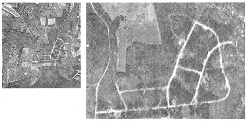
Figure 4.1. identifies the first lots sold. The first purchased was B-1 (the most darkly shaded in Figure 4.1), bought by a person named Brown in June 1945 for $930. A Mr Chrisman bought the second lot (lot A-1,) directly across Stonington. Prices for the 82 lots sold during the 1945-47 period averaged $1684 and ranged from the initial $930 purchase mentioned to $420 for a plot bought in July 1947.
Average Lot Prices by Time Period*| Period | Lots Sold | Price |
|---|---|---|
| 1945 June-Dec. | 17 | $1130 |
| 1945 Jan.-June | 33 | $1577 |
| 1946 July-Dec. | 23 | $1976 |
| 1947 Jan.-June | 5 | $2085 |
| 1947 July-Nov. | 4 | $2737 |
The great majority of buyers were individuals rather than speculative realtor or builders. Sixty-six people bought single plots, six purchased two each and one bought four. Most of these multiple purchases were of contiguous plots, suggesting that the buyers simply wanted larger home tracts. Some early buyers bought tracts as an investment and others had to abandon hopes to build. We are aware of only 9 original buyers during the 20 year period who later moved here. Some transferred from the area to business or career opportunities elsewhere and others lost their resolve to build be- cause of such factors as the strenuous competition for materials in short supply following World War II.
Inevitably the deep quiet of the forest was broken by the strange new sounds of lot clearing, street construction, well drilling and house building. Families came during weekends, holidays and vacations, summer and winter, cager to accomplish the work and savor the adventure they had planned for so long. Some began before the first crude roads were cut through - packing gear, lunches and perhaps infant children through the woods and stumps to their tracts. Thudding sounds of axes, whine and sputter of chain saws, the swish-swish of the hand crosscut, crash of falling trees, shouts of excited children, the eager talk between new-made friends who would be future neighbors, the roar and chatter of the inevitable bulldozer; smells of freshly disturbed earth, hot asphalt, burning brush and cooking fires. Niches were cut out of the forest where the houses would go. BUT THEY LEFT MOST OF THE TREES! Deer and other wild life retreated deeper into the woods.
Logs were cut up and piled for fireplaces-to-be; some were sold for lumber or pulp wood. Families brought city dweller friends out to share in combined work-picnic activities. Children used the wild setting for old and new games; excited by the glint of mica particles, youngsters played at "gold mining." Household dogs were driven to frenzy by scent of wild game. Families marked each other's progress and exchanged labor and ideas on building and landscaping. Most early families postponed major construction several years after purchasing tracts. For example, of 13 families who bought open lots during 1945-48 and became residents, one built and occupied the home within 2 years, seven waited 4 to 6 years and five waited 7 or more- the longest being 15 years. Figure 4.5 reveals some of the clearing and building operations completed or underway in 1948.
The forest was dark and lonesome during the early days. Later citizens cannot visualize the appearance in those days - the approach over old Kemp Mill Road past the horse farms to the simple sign at the entrance. It was truly a wilderness of great and smaller trees with the undergrowth of holly, dogwood, mountain laurel, vines, and crowsfoot.
After World War II, a friend of Mel Leonberger (resident on Remington Drive) had read the ad relative to the wooded lots being sold in Springbrook Forest. The friend had great visions of building a home and with that large parcel of land he could raise chickens. After negotiating for the property, located in the vicinity of Auth and Stonington, he found much to his disappointment that the raising of chickens was not allowed, so he gave up his vision. Years later he was sorry that he did not build. This was the last time that Leonberger ever thought of Springbrook Forest until 1957-'58 when he was looking for land to build a house. FOREST John Ohlmacher (a resident of the Forest) talked him into looking in the Forest for land. On a Sunday afternoon the deal for land on Remington Drive was closed with a handshake. After all the hard work and help of Ohlmacher during construction, Leonberger concluded it was the best thing he had ever done - building and moving into the Forest.
The new Forest streets were better than the roads outside. It was easy to get stuck in mudholes and snowdrifts along Kemp Mill, especially at the lowest point just below present Spring MillSchool. Children usually walked to and from the school bus stop at the entrance. Some property taxes were as low as $149 the first year.
The sights and sounds of hounds chasing game were common. Hunting was good, engaged in mostly by trespassers from outside who had hunted the area for years. Raccoon hunters and their dogs gathered for the hunt usually at the lower end of Rockford Road. An early favorite sledding place was east down Stonington and around the turn onto Auth Lane. A later popular slide was around the big bend on Remington - and for the "daredevils", of the road and on down through the timber. Bonfires and wiener roasts were common - with parents joining in.
Seventeen families moved in during the first 3 years; about half the homes had been completed and occupied within 7years and nearly three-fourths within 9years. The period of most rapid settlement was 1954-56 when 40% of the original families came. At least 21 families are credited with constructing their homes with their own skills and labor.
All of the properties here, from earliest years to the present, have been built as single family homes intended for owner occupancy; most of the few tenant residents have rented from absent owner families expecting to return This owner occupant pattern of predominantly middle- and upper-middle income families and such other factors as natural physical features, lot size and the strategic location of the neighborhood have combined to contribute very great influences on the favorable beginning, development and stability of the Forest as na attractive and wholesome place-to live and rear children. The significance of these factors is demonstrated repeatedly as our story unfolds.
While pursuing similar goals, families experienced common problems. Many of their difficulties stemmed from the Forest's physical location - in the population void between Georgia and New Hampshire Avenues, thus lacking in public services. By end of 1951 there were still only 20 households here, some widely scattered over the 200 acre area and as far as a mile from the entrance.
Examples of problems: Getting children to schools several miles distant; assuring safe recreation for them here far from established play fields; completing the clearing and landscaping of tracts and concern for the over-all appearance within the Forest and of the approaches to it; establishing feasible safeguards to replace the Moss covenants when these would expire; fire protection without water mains; inadequate trash collection; trespassing; which local government units or other bodies would be willing to listen and able to help. Such problems inevitably dominated talk between neighbors and at social gatherings. Eventually people realized their need for some neighborhood organization to facilitate effective communication and discussion and to formalize group decisions and actions.
On March 17; 1952 the Springbrook Forest Citizens Association was born at a meeting for Springbrook Forest home owners'. Representatives of 16 families attended, also Mr. Moss who was present to advise and assist in 1) setting up a belated local Home Building Plans Approval Committee to replace the expired Moss "Committee" and 2) organizing a citizens association.
The group met next in August with 18 families represented. Mr. Smith presented his committee's draft constitution and by-laws for a Springbrook Forest Citizens Association which was adopted the same evening after being clarified and strengthened at basic points. Meetings would be held monthly on the 3rd Wednesday except during July, August and September. Membership would be limited to Forest owners and annual dues were set at $5.00 per family. Voting rights of absentee members were spelled out. Nominations for offices were made for election the next month - the group agreeing they should meet in September because of urgent problems confronting them. (NOTE: It is of special interest that our Association has held firmly to the original pattern of monthly meetings during its entire history except that the December meeting has been eliminated. It seems especially significant that very few monthly meetings have been canceled during the entire 50 years of the association.)
A few of the association's major activities in the October 1952 - September 1954 time frame illustrates the type of problems dealt with.
A Building Committee to replace the Moss Building Committee whose authority had expired was established. Authorizing documents were given to Attorney Ralph Shure to determine their legality. He gave the opinion that the new committee could replace the Moss Committee by securing an amendment to the original Declaration of Restrictions. However this would require that "all present land owners - - join in such an instrument" because "a covenant must run with the land to be enforceable and is not effective unless all owners in the particular subdivision effected so declare it to be." This seemed to present insurmountable difficulties - those of gaining the acceptance of all tract owners.
In May 1953 the Committee was authorized to request the County's Office of Building Inspector to supply the Association with copies of applications for building permits. These arrangements worked fairly well. However, the Forest was about to experience its most rapid growth - forty-two new homes would be built and occupied during 1954-56. The committee worked valiantly; some applicants were unwilling to accept the Association's disapproval as binding. Preston Stang reminisced in 1969 that "This became a very unpopular committee!" Eventually the Committee stopped functioning.
Police assistance was requested when dumping by outsiders began within the Forest and continued along Kemp Milland Arcola even after the county had cleaned up the rubbish at the latter point and erected NO DUMPING signs.
The Triangle was a tangle of trees, brush, vines and stones. A few volunteers began clearing it.
The unsightly appearance and often hazardous conditions at the Kemp Mill - Arcola Intersection and along Kemp Hill Road annoyed Forest residents - it was the principal approach to the community. In October 1952 and again in January the Association renewed contacts with county authorities about the situation, especially the indiscriminate dumping of rubbish. Erection of NO DUMPING signs and police cooperation partially relieved the situation. The modest direction sign to the Forest was repaired.
In May 1953 the Citizens Association voted to join Allied Civic Group, an association of citizens associations. The Forest's first request for specific ACG guidance and support was made in March 1956 in connection with the "Day Nursery' Problem", a potential violation of aForest covenant and a county ordinance. The "problem" was that a family moving to the Forest planned to operate a day nursery.
Forest covenants stated that "parcels shall be used exclusively for private dwelling house purposes- - for the exclusive use of the owner or occupant." Forest delegates to ACG consulted that group's Zoning Committee, were advised on prohibitive county ordinances and Board of Appeal procedures and were assured that ACG would support Forest representatives at any hearing on the day nursery. In February the Association passed a landmark resolution - that ti " - - is opposed in accordance with the existing covenants to the establishment of a nursery school operation or any other deviation from strictly residential use - - " within Springbrook Forest. This formal 1954 action by the Association established a precedent and has provided a deterrent to other actual and potential violations of the specific covenant involved.
Serious fire was a continuing threat because of the need for burning brush after clearing and the long accumulation of forest litter on unoccupied tracts. Widely scattered household wells provided the only source of water, and the nearest fire station was at Four Corners 3miles away. The Association endorsed the proposed county "Fire Bill" which when enacted gave citizen groups a stronger voice in the planning and administration of Department facilities and services.
The first community picnic was called a "barbecue" and held on Sunday November 1, 1953 at the 'Zindels - the forerunner of the gatherings we have enjoyed every Autumn since then. The Association approved an expenditure of $20 from treasury funds. The 1954 and 1955 affairs were in October, also at Zindels. For many years the picnic was held at some public recreation facility to accommodate increased attendance. In recent years the picnics have again been held at homes in the Forest.
There was continuing uncertainty as to where and when children might be transferred to what school, especially those in elementary grades. They had attended Glenmont School until they were reassigned in 1953 to Glen Haven for 3years. Junior high youngsters went to Montgomery Hills until transferred to Wheaton in 1951. Senior high students attended Blair High until Northwood opened in 1956. Parochial school children went to St. Bernadette's until St. Andrew's was built.
In this chapter we have followed how the relatively isolated forest "wilderness" became a lively neighborhood of 46 houses by 1954. Today the Forest contains about three times as many homes and has a diverse makeup of residents all of whom love trees and have come "back to the land in Springbrook Forest".